Homeowners - Flood Risk Resources
As a homeowner, it is important that you know your current and future flood risk status. To help aid your research, the Maryland Department of the Environment has created the Flood Risk Application to help you make informed decisions about flood risk. This step-by-step interactive process is designed to help you understand your flood risk and what your next steps should be based on your personalized results. If you live in a community where flood maps are being updated determining your flood risk is an important task. Updates to the maps, which are occurring thoughout the state, can affect your flood insurance.
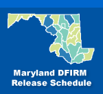
Using the schedule for map production in 2017, the average age of the DFIRM products in the Maryland is 4 years with 75% of the State at 3 years or less. Currently, 4 of the 6 oldest floodplain mapping products are in production to be remapped. MDE is the Cooperating Technical Partner (CTP) on three of these products in Baltimore City, Baltimore County, and Montgomery County. FEMA’s Risk Assessment, Mapping and Planning Partners (RAMP) is producing the DFIRM product in Frederick County.
How Updated DFIRMs Affect You
The DFIRMs are being released on a community by community basis. It is important to investigate your flood risk status and contact your insurance agent to make necessary modifications to your coverage while the maps are still preliminary. Acting now could save you money.
DFIRM Updates and Your Insurance
If your building is not currently in the floodplain, but will be in the future based on the updated DFIRM, it is important to get your insurance before the updated maps become effective, as you may qualify for a plan at a reduced rate. If your building is currently in the floodplain, it is still important to check your future flood risk status, as your coverage may need to change based on your situation.
Talking to your insurance provider is recommended if your building is in or out of the floodplain to make sure you are protected. Note: Some mortgage providers may also require flood insurance if the floodplain is on your property and does not touch your building.
Using Maryland's Flood Risk Resources
Based on the location you select on the map, the Flood Risk Application will help you determine your current flood risk based on effective Flood Insurance Rate Maps (FIRMs) and assess your future flood risk based on preliminary Digital FIRMs (DFIRMs). The application will also prompt you to launch a Flood Risk Guide, which will help you determine whether flood insurance is required or recommended for your property and how to obtain insurance if you do not already have it.
Before You Begin
We recommend gathering what information you already have. Consider the following:
- If you already have flood insurance, locate a copy of your policy in your files or obtain it from your insurance agent.
- If you are not sure if you have flood insurance, contact your insurance agent to inquire. Flood damage is not covered by homeowners insurance; therefore, your flood insurance is separate from your homeowners insurance.
Preliminary Schedule
- St. Mary's County - November 2022: Riverine
- Montgomery County - July 31, 2023: Riverine
- Howard County - Winter 2024: Riverine
Effective Schedule
- Frederick County - August 2023: Riverine (completed)
- Baltimore County - November 2023: Riverine
- St. Mary's County - Summer 2024: Riverine
- Montgomery County - March 2025: Riverine


