Additional Resources
National Flood Insurance Program
The national flood insurance program is operated by FEMA and is intended to provide an alternative to disaster assistance by helping citizens
manage their flood risk with the appropriate flood insurance. To read more about the National Flood Insurance Program please
visit https://www.fema.gov/national-flood-insurance-program
To read more about insurance as it relates to the NFIP, visit Floodsmart.gov
Digital Flood Mapping Products
FEMA began the digital conversion of its flood maps October 1, 2009. For additional information on the Digital Flood Insurance Rate Maps (DFIRMs) please visit the following site: https://www.fema.gov/flood-mapping-products
FEMA's Map Service Center
The Map Service Center has flood hazard mapping information and products that may be reviewed online and downloaded at https://msc.fema.gov/portal/home. For map orders and questions call 1-800-358-9616.
Hurricanes Harvey and Irma: Recovery and Next Steps
- Build back safer and stronger
- Science resources
- Guide to mold cleanup
- Turning power Back on
- Rebuilding Checklist
- Tips for returning to a flooded building
- Homeowner Flood Insurance Affordability Act
FEMA Outreach Mapping Material
- Biggert Waters Factsheet
- NFIP Reform Bill 2012 (PDF)
- Biggert Waters Flood Insurance Reform Act 2012 (PDF)
Maryland Department of the Environment Resource Material
- MDE DFIRM Program Brochure (PDF)
- MDE Flood Insurance Fact Sheet (PDF)
- MDE Fact Sheet and Rate Maps (PDF)
- MDE Flood Risk Guide (PDF)
- MDE Postcard (PDF)
- NFIP in Maryland (PDF)
- About the Maryland DFIRM Program (PDF)
- What New Floodmaps Mean to You (PDF)
- Homeowner's vs. Flood Insurance (PDF)
FEMA Resource Materials
Insure Your Risk
- Answers to Questions About the NFIP
- Benefits of Flood Insurance vs. Disaster Assistance
- Elevation Certificate
- Grandfathering
- Increased Cost of Compliance Coverage How You Can Benefit
- Know Your Flood Risk
- Myths and Facts about the NFIP
- Summary of Coverage
- Things You Should Know About Flood Insurance
Know Your Risk
- Appeals and Protests
- Checklist for Meeting the Criteria for Accrediting Levees
- Why We Map Flood Risk
- Flood Hazard Web Mapping Site
- Levee Talking Points
- Moving to Digital Information
- MT-1
- MT-2
- MT-EZ
Mitigate Your Risk
- Code Of Federal Regulations
- Community Rating System
- FEMA Publication Catalog
- FEMA 480 Study Guide
- Floodplain Management Ordinance Standard Operating Procedure
- Floodplain Management
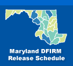
Preliminary Schedule
- St. Mary's County - November 2022: Riverine
- Montgomery County - July 31, 2023: Riverine
- Howard County - Winter 2024: Riverine
Effective Schedule
- Frederick County - August 2023: Riverine (completed)
- Baltimore County - November 2023: Riverine
- St. Mary's County - Summer 2024: Riverine
- Montgomery County - March 2025: Riverine


