
Glossary
Administrator means the Federal Insurance Administrator.
Agency means the Federal Emergency Management Agency, Washington DC.
Area of shallow flooding means a designated AO AH, AR/AO, AR/AH, or VO zone on a communitys Flood Insurance Rate Map (FIRM) with a 1 percent or greater annual chance of flooding to an average depth of 1 to 3 feet where a clearly defined channel does not exist, where the path of flooding is unpredictable, and where velocity flow may be evident. Such flooding is characterized by ponding or sheet flow.
Area of special flood hazard is the land in the floodplain within a community subject to a 1 percent or greater chance of flooding in any given year. The area
may be designated as Zone A on the FHBM. After detailed ratemaking has been completed in preparation for publication of the flood insurance rate map, Zone A usually is refined into Zones A, AO, AH, A130, AE, A99, AR, AR/A130, AR/AE, AR/AO, AR/AH, AR/A, VO, or V130, VE, or V. For purposes of these regulations, the term special flood hazard area is synonymous in meaning with the phrase area of special flood hazard.
Basement means any area of the building having its floor subgrade (below ground level) on all sides.
Base flood means the flood having a one percent chance of being equaled or exceeded in any given year.
Building see structure.
Coastal high hazard area means an area of special flood hazard extending from offshore to the inland limit of a primary frontal dune along an open coast and any other area subject to high velocity wave action from storms or seismic sources.
Community means any State or area or political subdivision thereof, or any Indian tribe or authorized tribal organization, or Alaska Native village or authorized native organization, which has authority to adopt and enforce floodplain management regulations for the areas within its jurisdiction.
Digital Flood Insurance Rate Map (DFIRM) is an electronic version of the paper Flood Insurance Rate Map (FIRM) that can be displayed in a Geographic Information System (GIS) or other computerized mapping system.
Eligible community or participating community means a community for which the Administrator has authorized the sale of flood insurance under the National Flood Insurance Program.
Existing construction means for the purposes of determining rates, structures for which the start of construction commenced before the effective date of the FIRM or before January 1, 1975, for FIRMs effective before that date. Existing construction may also be referred to as existing structures.
Existing structures see existing construction.
Federal Emergency Management Agency (FEMA) is a federal agency within the Department of Homeland Security that administers the National Flood Insurance Program (NFIP).
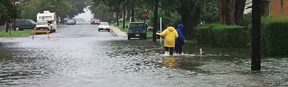
Flood or Flooding for purposes of the National Flood Insurance Program (NFIP), a flood is an unusual rise in waters covering two acres or more of land or two or more properties. In this case, streets are included in the definition of property.
Flood elevation study means an examination, evaluation and determination of flood hazards and, if appropriate, corresponding water surface elevations, or an examination, evaluation and determination of mudslide (i.e., mudflow) and/or flood-related erosion hazards.
Flood insurance means the insurance coverage provided under the Program.
Flood Insurance Rate Map (FIRM) means an official map of a community, on which the Administrator has delineated both the special flood hazard areas and the risk premium zones applicable to the community.
Flood Insurance Study (FIS) see flood elevation study.
Floodplain or flood-prone area means any land area susceptible to being inundated by water from any source.
Floodplain administrator is the official responsible to submit a report to the Administrator concerning the community participation in the Program, including, but not limited to the development and implementation of floodplain management regulations. This report shall be submitted annually or biennially as determined by the Administrator.
Floodplain management means the operation of an overall program of corrective and preventive measures for reducing flood damage, including but not limited to emergency preparedness plans, flood control works and floodplain management regulations.
Floodplain management regulations means zoning ordinances, subdivision regulations, building codes, health regulations, special purpose ordinances (such as a floodplain ordinance, grading ordinance and erosion control ordinance) and other applications of police power. The term describes such state or local regulations, in any combination thereof, which provide standards for the purpose of flood damage prevention and reduction.
Flood protection system means those physical structural works for which funds have been authorized, appropriated, and expended and which have been constructed specifically to modify flooding in order to reduce the extent of the area within a community subject to a special flood hazard and the extent of the depths of associated flooding. Such a system typically includes hurricane tidal barriers, dams, reservoirs, levees or dikes. These specialized flood modifying works are those constructed in conformance with sound engineering standards.
Floodway see regulatory floodway.
Freeboard means a factor of safety usually expressed in feet above a flood level for purposes of floodplain management. Freeboard tends to compensate for the many unknown factors that could contribute to flood heights greater than the height calculated for a selected size flood and floodway conditions, such as wave action, bridge openings, and the hydrological effect of urbanization of the watershed.
Geographic Information System (GIS) is a system of software, hardware, spatial data, people, and certified technical procedures that allows the user to display information, analyze data and create maps.
Insurance company or insurer means any person or organization authorized to engage in the insurance business under the laws of any State.
Levee means a man-made structure, usually an earthen embankment, designed and constructed in accordance with sound engineering practices to contain, control, or divert the flow of water so as to provide protection from temporary flooding.
Levee System means a flood protection system which consists of a levee, or levees, and associated structures, such as closure and drainage devices, which are constructed and operated in accordance with sound engineering practices.
Maryland Department of the Environment (MDE) is an executive branch department within Maryland State government, and is the State coordinating agency of the NFIP responsible for coordinating the update of DFIRMs for counties throughout Maryland; the department also offers technical assistance on the NFIP.
National Flood Insurance Program (NFIP) was created by Congress in 1968 to help provide a means for property owners to financially protect themselves. The NFIP offers flood insurance to homeowners, renters, and business owners if their community participates in the NFIP. Participating communities agree to adopt and enforce ordinances that meet or exceed FEMA requirements to reduce the risk from flooding.
100-year flood see base flood.
Participating community, also known as an eligible community, means a community in which the Administrator has authorized the sale of flood insurance.
Policy means the Standard Flood Insurance Policy.
Premium means the total premium payable by the insured for the coverage or coverages provided under the policy. The calculation of the premium may be based upon either chargeable rates or risk premium rates, or a combination of both.
Program means the National Flood Insurance Program authorized by 42 U.S.C. 4001 through 4128.
Regulatory floodway means the channel of a river or other watercourse and the adjacent land areas that must be reserved in order to discharge the base flood without cumulatively increasing the water surface elevation more than a designated height.
Special flood hazard area see area of special flood hazard.
Special hazard area means an area having special flood, mudslide (i.e., mudflow), or flood-related erosion hazards, and shown on an FHBM or FIRM as Zone A, AO, A130, AE, AR, AR/A130, AR/AE, AR/AO, AR/AH, AR/A, A99, AH, VO, V130, VE, V, M, or E.
Standard Flood Insurance Policy means the flood insurance policy issued by the Federal Insurance Administrator, or an insurer pursuant to an arrangement with the Administrator pursuant to Federal statutes and regulations.
Start of Construction (for other than new construction or substantial improvements under the Coastal Barrier Resources Act (Pub. L. 97348)), includes substantial improvement, and means the date the building permit was issued, provided the actual start of construction, repair, reconstruction, rehabilitation, addition placement, or other improvement was within 180 days of the permit date. The actual start means either the first placement of permanent construction of a structure on a site, such as the pouring of slab or footings, the installation of piles, the construction of columns, or any work beyond the stage of excavation; or the placement of a manufactured home on a foundation. Permanent construction does not include land preparation, such as clearing, grading and filling; nor does it include the installation of streets and/or walkways; nor does it include excavation for a basement, footings, piers, or foundations or the erection of temporary forms; nor does it include the installation on the property of accessory buildings, such as garages or sheds not occupied as dwelling units or not part of the main structure. For a substantial improvement, the actual start of construction means the first alteration of any wall, ceiling, floor, or other structural part of a building, whether or not that alteration affects the external dimensions of the building.
State means any State of the United States, the District of Columbia, Puerto Rico, the Virgin Islands, Guam, American Samoa, and the Commonwealth of the Northern Mariana Islands.
State coordinating agency means the agency of the state government, or other office designated by the Governor of the state or by state statute at the request of the Administrator to assist in the implementation of the National Flood Insurance Program in that state.
Structure means, for floodplain management purposes, a walled and roofed building, including a gas or liquid storage tank, that is principally above ground, as well as a manufactured home. Structure, for insurance purposes, means:
(1) A building with two or more outside rigid walls and a fully secured roof, that is affixed to a permanent site;
(2) A manufactured home (a manufactured home, also known as a mobile home, is a structure: built on a permanent chassis, transported to its site in one or more sections, and affixed to a permanent foundation); or
(3) A travel trailer without wheels, built on a chassis and affixed to a permanent foundation, that is regulated under the communitys floodplain management and building ordinances or laws.
For the latter purpose, structure does not mean a recreational vehicle or a park trailer or other similar vehicle, except as described in paragraph (3) of this definition, or a gas or liquid storage tank.
Water surface elevation means the height, in relation to the North American Vertical Datum (NAVD) of 1988, (or other datum, where specified) of floods of various magnitudes and frequencies in the floodplains of coastal or riverine areas.
V Zone see "coastal high hazard area."


Preliminary Schedule
- St. Mary's County - November 2022: Riverine
- Montgomery County - July 31, 2023: Riverine
- Howard County - Winter 2024: Riverine
Effective Schedule
- Frederick County - August 2023: Riverine (completed)
- Baltimore County - November 2023: Riverine
- St. Mary's County - Summer 2024: Riverine
- Montgomery County - March 2025: Riverine